Draft Report Released
Masterplan Released
Year 1
Year 2
Year 3
Information
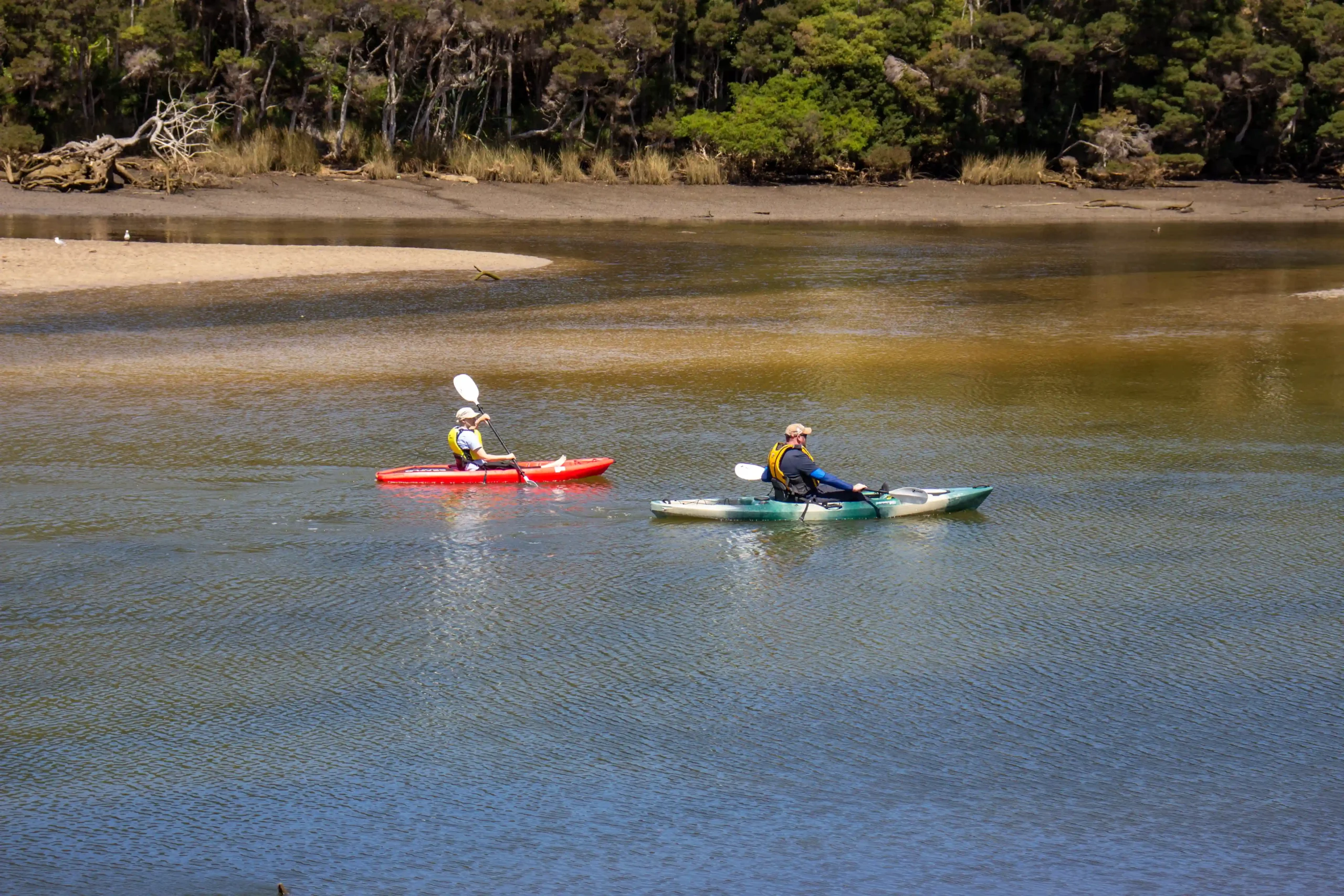
The Cam River Reserve Master Plan will provide Council with a clear vision for the future development and management of the area. The reserve is recognised as a significant parkland in Waratah-Wynyard and it will continue to be developed as a naturally beautiful riparian reserve for relaxation, leisurely activity and social interaction.
The master plan sets out to address key objectives of managing safety and pedestrian circulation, enhancing and protecting the natural values of the reserve and creating a natural entrance to the eastern side of the municipality.
In summary, the master plan proposes a total of 23 actions over the five-year period to cover the elected themes of safe access and circulation; relaxation and amenities; nature, art and design; and passive recreation. The actions within the plan address key community concerns around losing open space, losing the natural character of the reserve and pedestrian safety. Additionally, the master plan also considers community aspirations recognised through the initial engagement period, such as including options for a heritage walk and providing more amenities that support picnicking and relaxation.
YEAR 1 (2020 TO 2021)
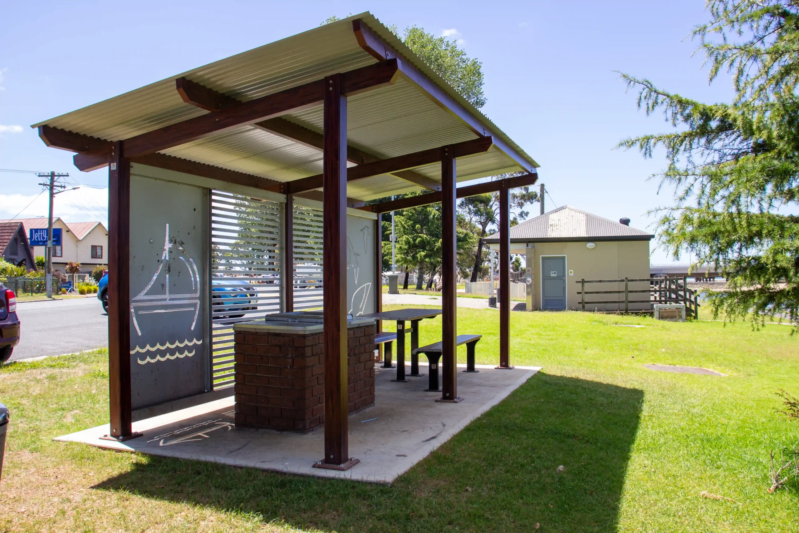
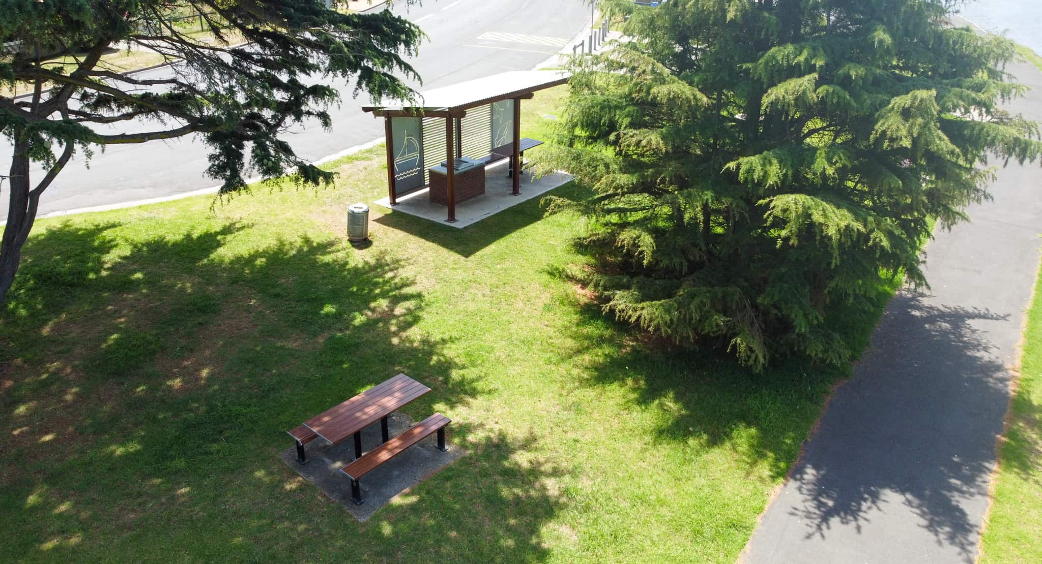
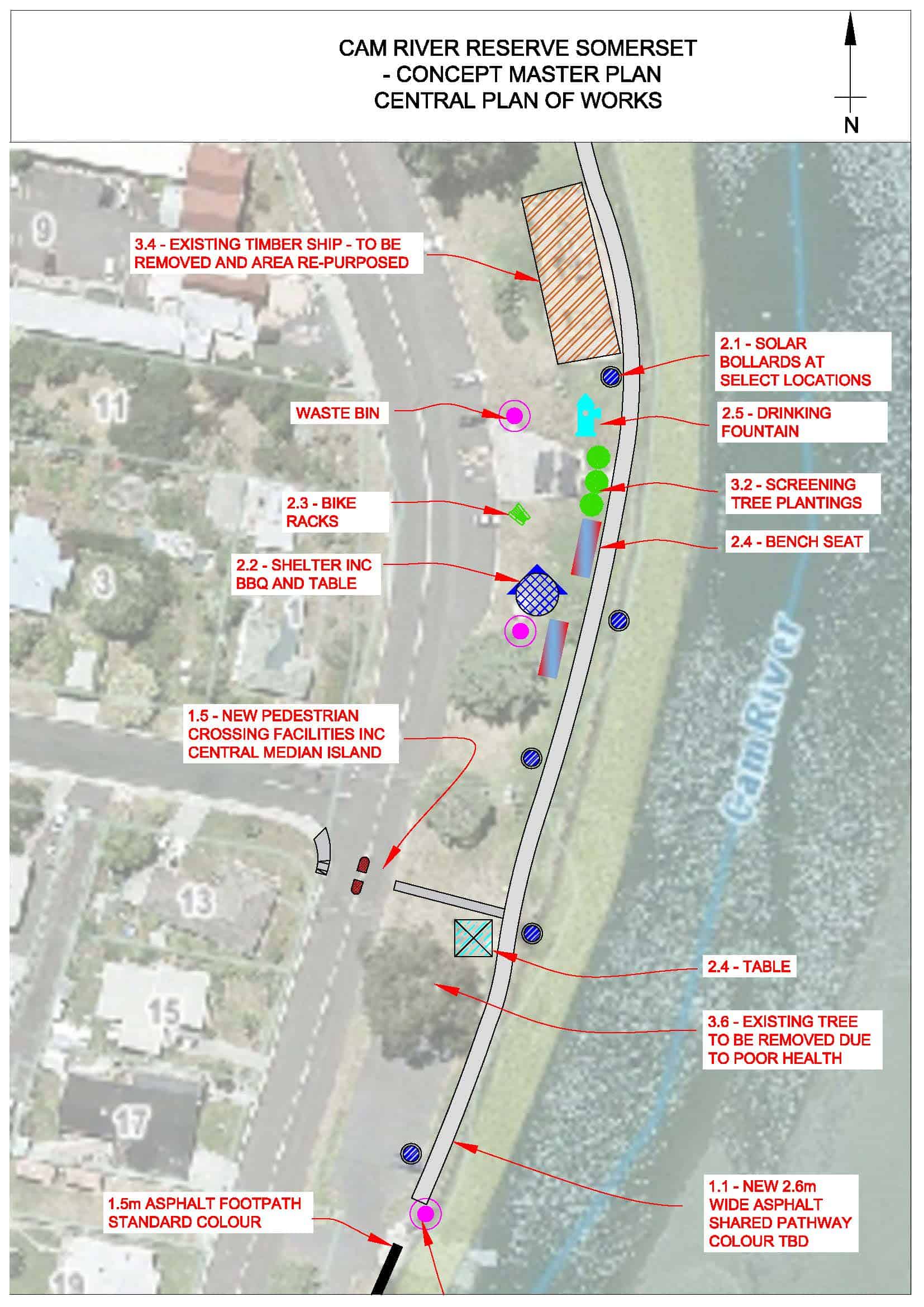
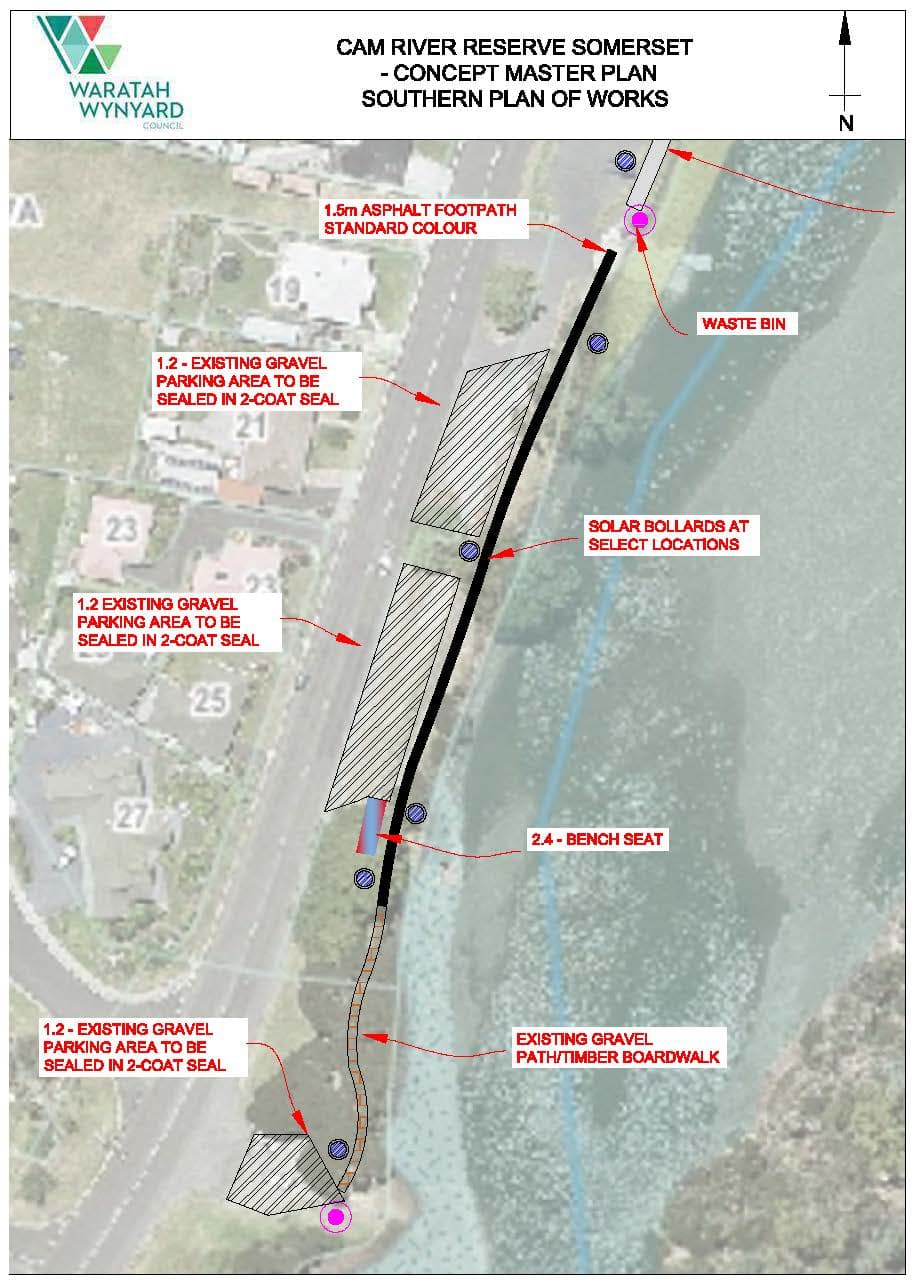
Construction of a new BBQ pavilion, tables and benches has been completed. Works have commenced sealing the walking path south of the play boat, with the remainder to be completed in year 5. The sealing of existing car parks has also been completed. The existing gravel parking areas and walking path (south of the play boat) have been sealed.
YEAR 2 (2021 TO 2022)
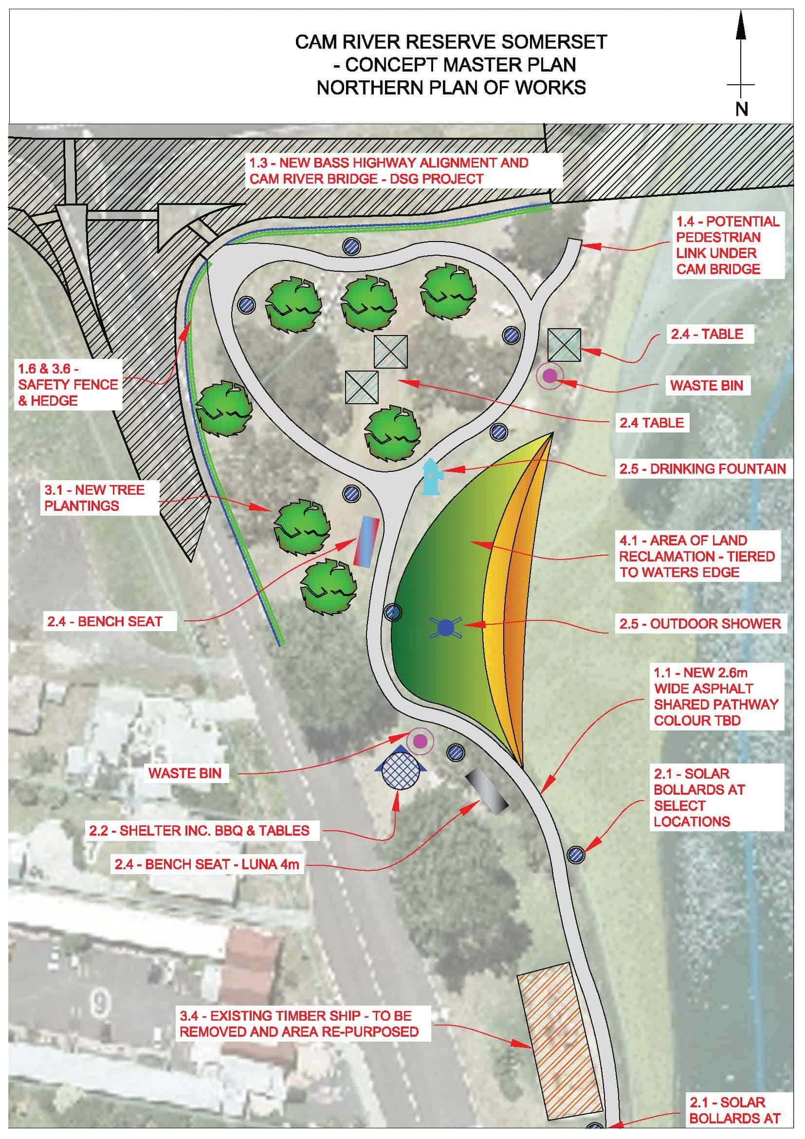
Council has successfully lobbied the state government for improved pedestrian access between Cam River Park and Anzac Park. Both parks will be accessible via a pathway under the new Cam River bridge. Installation of an outdoor gallery on the amenities block has been established.
YEAR 3 (2022 TO 2023)
During the public feedback period on the draft masterplan, Council heard that the existing playground (particularly the boat) is well-liked in the community. As a result of this feedback, amendments were made to the final master plan to ensure it was more in line with the community’s desires.
Council has called for submissions to create interactive art for the Cam River Reserve. The accepted artwork will be comprised of ten sculptures, being three boats and seven story oars. Manufacturing has commenced off-site.
Installation of the new outdoor shower and drinking fountains have yet to be completed.
FAQ
The nearby vehicular bridge crossing over the Cam River is an asset belonging to the Department of State Growth (DSG). In 2019, the DSG conducted a study over the Bass Highway between Cooee and Wynyard. The study included a risk assessment which highlighted the use of a wider and higher bridge may mitigate some risks associated with predicted traffic increases and flooding. The DSG have been developing a replacement bridge design which meets the recommendations contained within the study, which may include absorption of some of the reserve area to aid in road realignment.
As the maintenance and replacement of the bridge lies with the State Government, the Council have limited influence over how the bridge is designed or how much space is taken for the replacement. As part of the master plan, Council will liaise with the DSG to advocate for a minimised impact to the reserve and improved pedestrian access to the reserve.
The existing playboat is nearing the end of its functional life. Inspections have identified that the structure is beginning to rot and is no longer able to be repaired. For these reasons, Council have been planning for its replacement and exploring alternative opportunities for the site given there will be a grand new all-abilities playground located at the nearby Anzac Park.
During the public feedback period on the draft masterplan, Council heard that the existing playground (particularly the boat) is well-liked in the community. As a result of this feedback, amendments were made to the final master plan to ensure it was more in line with the community’s desires.
Council has called for submissions to create interactive art for the Cam River Reserve. The accepted artwork will be comprised of ten sculptures, being three boats and seven story oars.
Each sculpture will vary in size and will feature seats and raised picnic platforms into the designs. The story oars will depict the story of Cam River over time and have been designed by local students from Somerset Primary School.
Manufacturing of the artwork is well underway, and installation of the art is anticipated to occur in early 2024.
To improve pedestrian safety, vehicular access to the grassed areas of the reserve will be restricted. Temporary placement of rocks or bollards will occur after community consultation and will be in place until the construction of the new vehicular bridge is completed. A fence and hedge will be installed at the corner of the Bass Highway and Murchison Highways after the bridge works are finished.
Pedestrian access will be enhanced through the reserve by increasing the width of the main pathway to shared standards (over 2m wide) and by including a pedestrian access point at Simpson Street.
The Department of State Growth, which is responsible for the replacement of the bridge and the adjoining highways, have agreed to accommodate pedestrian access to Anzac Park via a pathway underneath the new bridge.