Consultation opens
Commence development of Master Plan
Feedback process for Draft Master Plan
Review of feedback and amendments period
Community consultation
Review of feedback recieved
Community awareness
Commence detailed planning
Planning and approvals
Year 1 actions
Year 2 actions
Detailed description
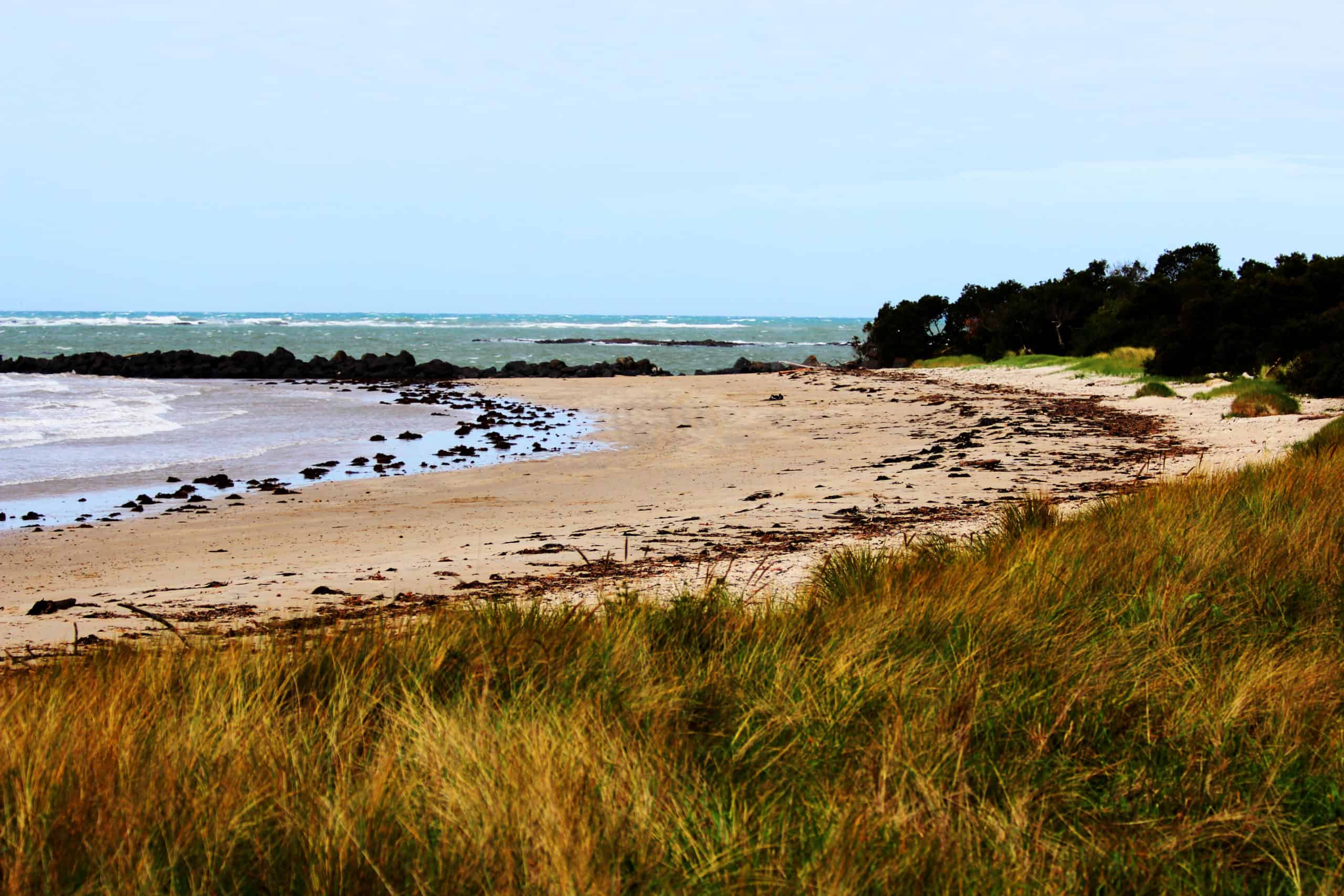
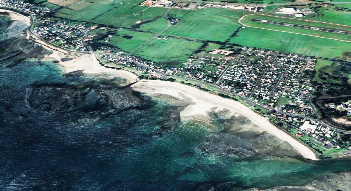
The East Wynyard Foreshore Master Plan will set a clear vision for the future management and beautification of the area. The reserve is recognised as being a key part of the community, particularly for its use for general recreation (walking, running and bicycling) and for being the home of the foreshore market. The reserve is typically the first parkland seen when entering the Wynyard township from the east.
The master plan intends to address key opportunities and challenges experienced within the reserve and builds upon the previous master plan proposing a total of 31 actions over a five-year period covering the five recognised themes of safe access & circulation; events & markets; nature relaxation & design; and active recreation.
The actions within the plan address community concerns for pedestrian safety, parking, lack of trees (shade), over development, overgrown vegetation, lack of amenities, erosion, vehicles on the beach and antisocial behaviour. In addition, the plan has recognised that the community has a desire to keep the natural look and feel of the reserve whilst also improving activities; for this reason, two distinct zones are acknowledged. The Passive zone will be a natural space designed for relaxation and may also be utilised for events and/or markets. The Active/Creative zone is planned as a vibrant space designed for social activity, health and wellbeing which is also, a space for fun and creativity.
The key activities that Council plan to deliver during the 2023/24 financial year include:
- Installation of a DDA compliant pedestrian connection across Old Bass Highway from the foreshore reserve, including a central refuge island.
- Install sign and promote existing viewing platform.
- Design and planning for the upgrade of the existing market storage shed.
- Planning for new and replacement foreshore furniture.
Waratah-Wynyard Council thanks all community members for their contribution to the development of the master plan.
FAQ
The Plan will set a clear vision for the future beautification and management of the area. It provides Council with a set of guidelines that addresses any safety concerns and community expectations around how the reserve is intended to be used and what infrastructure might support this. Future improvements to the area can then be planned based on the Master Plan.
The reserve is well-liked for a range of activities including walking, running and bike riding; for this reason the existing pathway will be widened (where possible) to shared pathway standards (2.6m wide) which will also connect it to the future coastal pathway project. The increased width will also apply to the boardwalk which is being renewed and will include a slip resistant product to improve use during cold and wet weather.
Additionally, to facilitate road crossings and improve sight lines during peak use, two pedestrian crossing points (including central refuge islands) will be installed. This will include connecting paths to the main walkway to enable all-ability access.
As parking is at a premium alongside the beach and the recent playground upgrades have created an even greater demand for parking Council will redevelop and extend current car parks. The redevelopment will be conducted in 2 stages to ensure the need is being met without being excessive.
- Stage 1: the ‘middle’ car park and car park adjoining the playground will be redeveloped and extended, moving them closer to the road to allow realignment of the pathway and increase available parking space.
- Stage 2: the remaining two carparks (near the western amenities block and at the boat ramp) may be upgraded and extended only after the pathway has been realigned and the results of a demand and traffic impact analysis have been undertaken.
It should be noted that stage 2 upgrades may not be necessary.
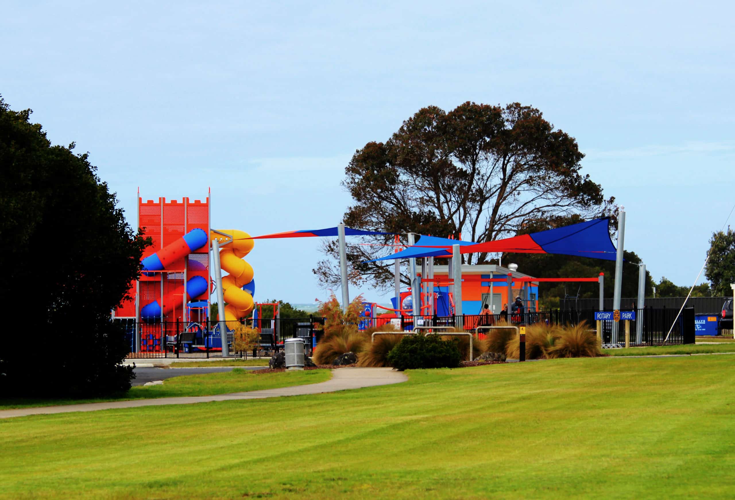
The current exercise equipment is now past its functional life and needs to be replaced in order to maintain safety. Once the current equipment is decommissioned, new equipment designed to suit a range of abilities and activity styles will be installed in the ‘active zone’ adjacent to the playground at Rotary Park, in line with Council’s Open Space, Sport and Recreation Plan (OSSR).